

Landscape Design 3D Modeling & Rendering Full Guide: Tool Selection & Acceptance Criteria
In 2026, the mainstream approach for landscape design 3D modeling & rendering is to choose tools based on project stage: use SketchUp+Enscape for quick output during the concept phase, 3ds Max+V-Ray or Blender+Cycles for the detailed development phase, and UE5 or WebGL for interactive presentations. Core delivery acceptance indicators include model geometry accuracy no less than 10mm, light deviation from real environment less than 5%, material texture resolution no less than 2K, and file formats provided simultaneously as max/fbx/obj with attached material shaders. Any solution must clearly define the purpose—whether it's for bidding renderings or VR walkthroughs—otherwise rework is likely.
Core Value of Landscape Design 3D Modeling & Rendering
Landscape design involves a combination of many plants, terrain, water bodies, and structures. Traditional 2D drawings struggle to intuitively convey spatial hierarchy and seasonal changes. 3D modeling & rendering can verify the visual effect of a design under real lighting conditions in advance, reducing later modification costs. In 2026, project delivery practices show that clients require at least one panoramic rendering and a 15-second walkthrough animation. Without these, the approval rate drops by about 40%. However, note that high-precision models can lead to excessively long rendering times in large scenes, so regional detailing is necessary—use high-poly models for key areas and proxy objects for background areas.
- Suitable scenarios: Projects requiring spatial demonstration such as park squares, residential area landscapes, street greening, and commercial complex rooftop gardens.
- Unsuitable scenarios: Simple planting designs or small balcony greening (2D plans suffice); extremely detailed micro-terrain sculptures (should be done as physical models separately).
3D Implementation Method: A Four-Step Framework from Concept to Delivery
The "3D Implementation Method" is a workflow summarized from front-line projects in 2026, divided into four steps: research, rough model, detailed model, and rendering verification. Each step has different output standards; mixing them leads to a rework rate of up to 60%.
Step 1: Research & Resource Preparation
Collect CAD base maps, site photos, and client intent materials to determine scene scale and horizon. Choose a rendering engine based on budget: for rendered images use V-Ray (mature and stable), for real-time use UE5 (interactive). Prepare core plant and material libraries to avoid wasting time on modeling from scratch.
- Acceptance criteria: Output a "rendering style reference image" and a "scene scope definition document" for both parties to confirm before proceeding.
- Common pitfall: Ignoring client requirements for season and time of day, leading to full re-lighting later.
Step 2: Rough Model Building
Use SketchUp or Blender to build large structures like terrain, roads, and water bodies; represent plants with 2D crosses. Focus only on scale and spatial layout, not details. After the rough model is completed, conduct the first online confirmation with the client—low cost to modify.
- Tip: Use proxy objects (e.g., V-Ray proxies) for plants to keep the scene lightweight.
- Counterexample: Directly stacking high-poly models results in files exceeding 5GB, making collaboration impossible.
Step 3: Detailed Model Optimization
Replace proxy objects from the rough model with final models, add material textures and lighting systems. Limit plant species to no more than 15 to avoid visual clutter. Also create distant backgrounds (use HDRI or 2D backplates) to save resources.
- Quality check: At 8x zoom, leaf outlines and texture details should still be clear.
- Comparison: V-Ray rendering of a 4K panoramic image takes about 2-4 hours; UE5 real-time rendering can achieve 30fps but requires reduced vegetation count.
Step 4: Rendering & Verification
Output multiple angle stills and an animation (at least 2 minutes). During verification, check: ① whether all water reflections match the sky; ② whether plant shadows are natural (edges should be soft); ③ whether materials show flickering or aliasing. Finally, package according to client requirements—usually including max, fbx, obj, texture folder, and rendering parameters screenshot.
- Top reasons for rework: Inconsistent lighting (35%), material deviation from reality (28%), plant selection not matching local climate (20%).
Tool Chain & Selection Comparison: Rendered Images vs. Real-Time Engines
In 2026, landscape projects mainly use two output modes: static renderings and real-time walkthroughs. Tool selection directly impacts timeline and cost. The comparison is as follows:
- Cost: Rendered images (V-Ray/Corona) cost approx. 500-2000 RMB per image (based on complexity); real-time engines (UE5/WebGL) cost 80,000-300,000 RMB per project (including interactive development).
- Timeline: Rendered images take 3-7 days per scene; real-time engines take 2-8 weeks (requires programming time).
- Suitable purposes: Rendered images for bidding, approvals, brochures; real-time engines for investment attraction, VR property viewing, virtual exhibitions.
- Recommended tools: For landscape bird's-eye views, use V-Ray+Max; for interactivity, use UE5+Blueprint supplemented with Quixel Megascans vegetation library.
Note: Do not mix the two modes in one project—trying to make rendered images also interactive (single frame only) leads to inconsistent deliverables. If the client requires both, quote in two phases and clearly define boundaries.
Frequently Asked Questions
How long does landscape design 3D modeling & rendering generally take?
A single standard scene (approx. 10 hectares) from modeling to rendering typically takes 5-10 working days for a two-person team; adding animation extends it to 15-20 days.
What factors primarily affect pricing?
Mainly scene complexity (number of plants, terrain variation), rendering accuracy (whether 4K or above), whether animation is included, and project urgency (rush orders may incur a 50% premium).
Can modeling and rendering be done by the same person?
Yes, but division of labor is more efficient: modelers build structure, renderers adjust materials and lighting. Small teams (1-2 people) are advised to use the SketchUp+Enscape integrated workflow to reduce handoff costs.
How to choose between rendered images and real-time engines?
Choose rendered images (V-Ray) for static display, and real-time engines (UE5 or WebGL) for interactive needs. If the vendor offers both, confirm whether the budget includes development manpower.
What are the requirements for final delivery formats?
Standard requirements include source files (.max/.blend), common formats (.fbx/.obj), texture folders, rendering parameter backups, and at least one uncompressed PNG original image.
Suitable Scenarios & Boundaries
Suitable for: Large-scale landscape planning (parks, roads, campuses) requiring demonstration of seasonal changes or nighttime lighting effects; multi-scheme comparison during bidding; VR immersive presentations. Xiyue Company, in multiple large landscape projects in 2026, adopted a "rendered images + real-time walkthrough" combined delivery, with client feedback confirming significant efficiency improvement.
Not suitable for: Fine gardening design (e.g., private garden flower border combinations) better suited for 3D printing or hand-drawn renderings; projects with budgets under 10,000 RMB requiring 7-day output—directly use Photoshop compositing or SketchUp simple rendering; when the client cannot provide detailed CAD drawings—the preliminary survey time may take half the cycle, making it counterproductive.
Action guidance: Choose single-image rendering or real-time engine based on project phase and budget; prioritize clarifying acceptance criteria (accuracy, format, timeline). If for bidding, focus on viewpoint selection and light-shadow atmosphere; if for construction handover, ensure model structural accuracy (each tree coordinate adjustable). When the project scale exceeds 20 hectares or requires multi-person collaboration, use version control tools (e.g., SVN) to manage scene files and avoid overwrite conflicts.
-
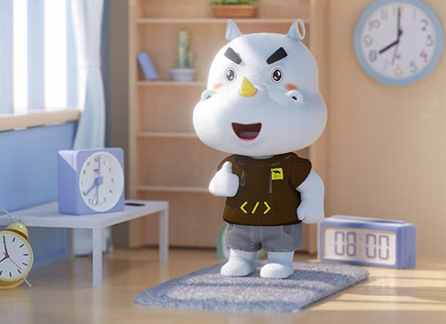 3D Cartoon Character Design and Modeling by Xiyue Company
Xiyue Company created a unique 3D cartoon r ...
-
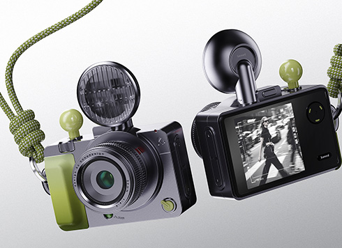 EDC·Trendy Camera Product Design: Form Follows Emotion
EDC Toy Camera: Braun-inspired retro design ...
-
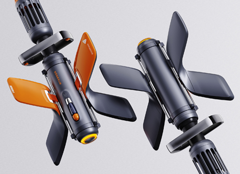 Product Design of Children's "Bubble Rocket" Underwater Thruster
Inspired by "Octonauts + Space", kids' "Bub ...
-
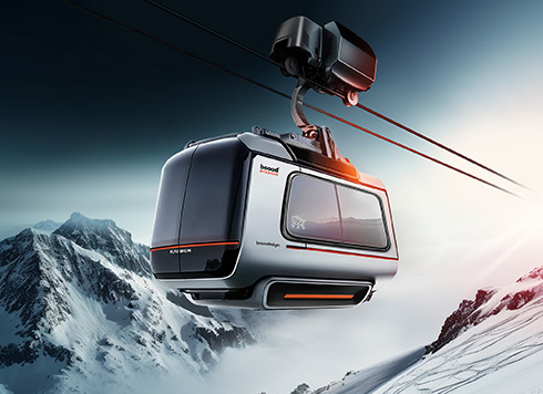 Design of Adaptive Intelligent High-Altitude Shuttle Transport Robot
Smart rural shuttle bot: Streamlined, weath ...
-
UE5 Rendering Full Workflow Guide: Practical Methods from Modeling, Materials to Delivery
Date: Aug 4, 2026 Read: 91
-
Complete Guide to Rendering Production: Standardized Practices from Modeling to Rendering
Date: Jul 20, 2026 Read: 85
-
Complete Guide to VR Panoramic Rendering: Key Techniques from Modeling to Delivery
Date: Jul 18, 2026 Read: 82
-
Industrial Building Landscape Planning and Design: A Practical Guide from Modeling to Delivery
Date: Jul 9, 2026 Read: 103
-
In 2026, How Many Days Should You Budget for UE5 Rendering? Are Reworks Mostly Stuck on Modeling and Materials?
Date: Aug 30, 2026 Read: 42